1/17/16

Day 5--Prineville, OR to John Day, OR

Day 5—June 23, 2006—Prineville, OR to John Day, OR—117 miles—5103’ climb

Everyone woke this morning with a feeling of uncertainty about their ability to finish one of the toughest days we have on our schedule. The distance is over 117 miles and riders were faced with over 5,000 feet of climbing. The only thing easy today was the navigation . . . turn left out of the motel, ride 117 miles, and turn right into the motel. We loaded early this morning (5:30 a.m.) to give riders a head start and to beat the heat on this very long day. Even so, most didn't beat the heat. Red faces and arms abounded at dinner. Also, the last riders got in after 7 pm, so some had a very long day in the saddle.

But no one is complaining. All of today's route was beautifully scenic. After the first climb, riders traveled through some magnificent Ponderosa Pine forests. Ravens croaked overhead and magpies and quail flitted through the underbrush. We pedaled along Ochoco Creek, Match Creek, Branch Creek, Mountain Creek, Rattlesnake Creek (and a host of others that wound their way down the canyons) and, of course we pedaled, along the John Day River, famous for its fly fishing.

Riders pose with the giant rocking chair
 before the Juniper Guy's shop

The town of Mitchell at mile 45 was a welcome little spot in the road on SH-26 E just before the ascent to Keyes Summit. It is one of only three places — Mitchell, Daysville, and Mount Vernon, all tiny towns — on today’s route where riders could get food. Once more some of the riders took me to task. I had again promised pie, but those who came first scarfed up every last slice. The subsequent riders were out of luck. Right next door to the cafe was the Juniper Guy (juniperguy.com) who was making interesting chairs, bed frames, and tables from juniper. He had a giant rocking chair out front and I took several photos of riders with it.

After reaching Keyes Summit, a tough climb, riders enjoyed a beautiful 25-mile downhill with a tailwind . . . it just doesn't get any better than that. Along with the great conditions, we definitely experienced sensory overload as the landscape was beyond description. High hills, rushing rivers, canyons, gorges, colorful rock formations. We descended into Picture Gorge which was just breathtaking. At one bend in the road a rock formation loomed above, looking for all the world like an ancient Incan temple. After we exited the canyon, we rode through a beautiful valley dotted with western style ranches until we reached John Day, a small but colorful town, most notable for being the end of our ride day.

Proud rider at the top of Keyes Summit
This group should be proud of their accomplishments today. It was a long, hot (94F) day, and they all came through with flying colors. At Route Rap we learned that this was the longest day several of the riders had ever ridden. We also had two people who rode their first century today, and we had two birthdays, Keith’s and Joyce’s.

CONGRATULATIONS TO ALL!

Today’s elevation view looked like an opera singer’s breast plate. Tomorrow’s looks like a shark’s jaw with three serious summits over 5,000 feet.

OVERHEARD ON THE ROAD TODAY:
  • “It’s pretty bad when the butterflies get to the top faster than I can.” 
  • “I would have gotten here sooner but I had to obey the speed signs outside of town.”
  • “I’d draft off you but I don’t have a kickstand.” 
  • Staff: “The sun will be lower on the horizon pretty soon.” Rider: “I hope so. It’s been high noon for the past four                                                                       hours.”
SHOW & TELL: Tim and Kathryn detoured through Mitchell and found the Mitchell mascot, a black bear kept in a large pen. Seems as though I remember someone discovering this poor bear last year also. They Reported that in Mitchell there was also a grocery, The Wheeler Country Trading Post selling groceries, hardware, sporting goods, and they also found the Little Pine Cafe, which looked like a fine place for lunch. Scott and Mike saw a bobcat leap a fence in one graceful bound. Several riders saw deer, and, of course, all saw the ground squirrels as they zipped across the road, tails high.

Day 6--John Day, OR to Baker City, OR

Day 6—June 24, 2006—John Day, OR to Baker City, OR—81 miles—4781’ climb

Our days in Oregon while challenging are also some of the most beautiful of the ride I think. Today we spent much of the day on the Elkhorn Scenic Route. We rode through two national forests: the Malheur National Forest (malheur means evil hour [bad fortune] and was named by the Hudson’s Bay Company’s Peter Skene Ogden who lost a cache of furs there in 1825) and the Wallawa-Whitman National Forest. Riders also climbed three mountain passes.The first--Dixie Pass at 5277’--has a large covered wagon viewpoint about 3.5 miles from the top. Many riders stopped there to take photos or to have their photos taken (see photo) and many shed some extra clothes after the exertion of the climb. Next, riders climbed to Tifton Mountain Summit at 5124’ and finally climbed to Snall Summit followed by a lovely 6-mile descent. We also crossed the John Day River again and followed the beautiful Powder River down through a canyon and into Baker City.

A Criterium was taking place in Baker City and our hotel was full of cyclists. The racers were as awed by our undertaking as we were of theirs. Their racing bikes were beautiful to behold. Many of our cyclists went into town to watch the Crit (see photo—this shot last year by Mike Munk). If we were going to be here for any length of time tomorrow, we’d get to watch a road race up the canyon we descended coming into town. The descent was exciting as a touring cyclist with its steeply banked curves (made me feel at times as though I was in a velodrome) and with the canyon walls and the Powder River on the right, so I imagine it will be twice as exciting for the racing peloton.


Our first SAG stop was at the Austin House Restaurant at mile 28. Here many of the riders sampled delicious huckleberry cobbler and ice cream, had a drink, bought a postcard, etc. Christine bought some Huckleberry flavored coffee (I’m trying to get her to brew some in our motel coffeemaker). Our second SAG was set up shortly after the little RR museum on Phillips Lake in a beautiful grove of ponderosa pines with picnic tables. This is one of my favorite SAG sites as I can bird and botanize. The SAG table flowers were wild flag and fox grass. An osprey nest with two young this year topped a tall tree trunk at the lake’s edge (and has for the past two years also). The adults were coming and going feeding their young.

All told, it was another beautiful day in paradise. All riders got in safely by about 5 and enjoyed the pool, talking to the racing cyclists, and eating a fine dinner at the hotel.

OVERHEARD ON THE ROAD TODAY:
  • Jim: “You can outrun a bull on your bike, no bull!” 
  • “This is a great SAG Stop. I think I want to sleep here tonight.” 
  • “Yum! Chips & salsa — very good—can we have them every day?”
SHOW & TELL: Jim stopped to take a photo and realized that the bull whose picture he was taking was on his side of the fence . . . ooops! Tim and Kathryn stopped at a wildlife lookout and saw some whiter specks moving about the mountain face high above. They did not have binoculars but assume these were mountain goats. Bob & Dave were just riding along minding their own business when they were confronted by a badger that stopped crossing the road long enough to let them know it was boss. One rider was stopped just before SS#2 so that a steam engine from the RR Museum could cross the road.

Day 7--Baker City, OR to Ontario, OR

Day 7—June 25, 2006—Baker City, OR to Ontario, OR—83 miles—2011’ climb

Yeeehaw! Most of today’s route spooled out like an unwinding ribbon. Riders enjoyed miles and miles of unearned downhill along old Route 30 and I-84 and then on SH-201 along the Snake River. Yesterday racers had their criterium race; today they had a road race (The Elkhorn Bike Classic) the route for which overlapped our route a bit, but was scheduled for later so there was no problem “getting out of Dodge.”

Since it was the first day riders would ride parts of the Interstate, I gave them Mike Munk’s protocol for Interstate riding at dinner last night: 1) Ride as far right on the shoulder as possible, 2) Get behind the guardrail when you have a mechanical or need to stop, 3) Avoid running over belted tire debris; these pieces of tire contain little tube puncturing wires, 4) Avoid pacelines, 5) Ride in small groups so that one person can always turn to face the traffic coming from behind if you are stopped, and, 6) most importantly, Cross on-ramps and off-ramps using the shortest distance between two points and beware of fast moving exiting and entering traffic. In fact, if you see a car coming, wait until it has exited or continued on before crossing the exit road. Cars travel much faster than cyclists.

To my knowledge we had no flats on the Interstate, maybe a record. Flatting on these shoulders dotted with tire bits is common. Today’s ride marked a couple of milestones, too: 1) At mile 32, just before the first SAG Stop, riders had 500 miles behind them; and 2) at about mile 48, riders crossed into the mountain time zone and were reminded to turn their watches ahead 1 hour

Once again, the scenery was spectacular. Many high brown grassy hills folded one behind the other, long swooping roadways cut through the hills and cliffs; cattle ranches, cattle and cowboys; vegetable farmers growing onions, sugar beets, corn, potatoes, wheat, and mint. Derelict wooden buildings, a cement plant, even one place where two RR tunnels cut through the hillside. Picture perfect romantic west . . . the unsuspecting would never guess that this was Oregon, our next to last day in the state.

Makeshift shade shelter along the Snake

Since SS #2 was at a gravel boat put-in on the Snake River with nary a drop of shade in sight, Jim fixed up the van last night by tying a tarp to the roof racks and placing the two bike stands in the back. When it came time to set up the SS, we stretched the tarp to the bike stands and anchored the whole thing with water barrels. This gave riders and staff some shade and the taller riders didn’t complain about having to stoop to stand under it.  

[ I later learned that the owner of the ABB touring company was upset with me for showing a photo of the jerry-rigged shade protection. It did not reflect well on the company he said. At this reserve I can see what he meant. The pic shows a jerry-rigged shelter. I wasn’t thinking . . . of the ABB company at least. I was thinking of the comfort of the riders and staff. Later I compounded this error by buying a canopy and then asking riders to voluntarily chip in a dollar or two to help pay for it. Of course one of the riders complained to the tour owner that such things should have been covered in the tour fee. Susan not thinking again.  Susan 2016]

Franz dipping in the Snake

Shade or no shade, Franz decided it was time to take a dip in the Snake when he arrived at the second SS, so stripped down to his bike shorts and swam way out into the river. Barb and Steve longed to do the same, but didn’t want to ride in wet shorts, so they waded in to cool their feet. Sara, too, waded in and soaked her doo-rag and jersey. These were all wise things to do because the day turned into a scorcher — 103˚F by the time the last rider pulled into the motel in Ontario. A couple of riders had a bit of trouble with the heat today, so Don (a marathon runner) took some time to explain what to do and what not to do on hot days. We staff have our misters ready, also a cooler full of iced towels and will be vigilant tomorrow in “running the line” in the SAG vans to ensure that riders have water and support when they need it.

Dinner at a Sizzler this evening revived everyone, and a Walmart Supercenter nearby helped the staff prepare for the days to come. Our motel is nearly on the Snake, which is the border between Oregon and Idaho, so tomorrow riders will enter their second state of the ride. Tune in then and see how things go.

OVERHEARD ON THE ROAD TODAY:
  • "Yeeeeeeeehaw!" 
  • “On your left!”

Day 8--Ontario, OR to Boise, ID

Day 8—June 26, 2006—Ontario, OR to Boise, ID—62 miles—1438’ climb

WOOHOO! WE’RE IN STATE NO. 2, BEAUTIFUL IDAHO THE STATE WHERE SPUDS GROW AND CATTLE TOO, AND THE SNAKE RIVER HISSES THROUGH CANYONS.

The first part of today’s route wends east on little trafficked farm-to-market roads bordered by small farms and occasional houses. The road rolled considerably and looked at times like a piece of ribbon candy. The first 15 miles contained 7 turns, so riders were kept alert checking their computers. Nonetheless a few riders missed a turn and got in some bonus miles. One pair called me on the van phone. “Help! We’re lost.” While working their way back to the route, they saw a line of red, white, & blue riders across the fields one road over. Just like goslings behind their mother, they happily lined up behind these riders.

Since it was a short day, we set up only one SAG Stop midway between Ontario and Boise. It was supposed to be in a large Shell station/CS. When I got there, however, I could find no place to park the van, so set up in the church parking lot across the street. This worked out very well as riders did not need to cross to the left side of the road. When I got to the SS, Deanna Livsey (rode the inaugural AAN in 2001) and her friend, Dana, were waiting with two big bags of cookies that Deanna had made and toted to the SS. The two had ridden their bikes out from Boise. They waited until fellow inaugural riders Sara and Christine (see photo below) arrived, and then gathered a group and rode back to Boise with them, showing them a slightly different route. Deanna had met us last year, too, having recently moved from the Chicago area to Boise. Thank you Deanna!

As riders neared Boise, the road became more urban, but continued to be quiet as the route veered off into a residential area and then eventually entered Hyde Park, an esoteric narrow spot on the road, and a favorite place for riders to stop for lunch before continuing to the hotel, about 2 miles away. Many riders had a sandwich or pizza at Lucky 13 right across from Richards, our usual lunch spot, which was closed.

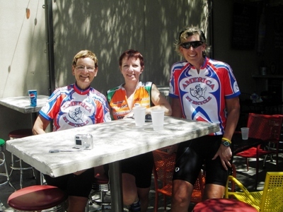
Christine with veteran riders riders Sarah and Christine
at lunch in a trendy section of Boise

Andy conducted R-Rap at 4, and I talked about what to see and do in Boise. After our day in the merciless heat yesterday, I bought a canopy at Walmart last night. At Route-R, I asked for $1 or $2 canopy donations (strictly volunteer) and received enough to meet the cost of the $88 canopy. Thank you riders! I know that you’ll think your donation was one of the best investments you’ve ever made as we cross wide open, sun-saturated Idaho, Wyoming, and South Dakota. Also at R-Rap, we said our final good-byes to riders Tracey Bail, Scotty Bolf, and Alan Williams whose northwestern leg ended in Boise. We will miss them.

Tomorrow should be a fun day for both staff and riders. We staff get to welcome three new riders, Leslie Margolin’s friend Kathy Griest, Mike Warmbier’s brother, Fred, and Jon Gregg’s nephew, Jason; and riders get to explore Boise and enjoy a little R & R.

OVERHEARD ON THE ROAD TODAY:
  • “This was a nice ride today. Thank you!” 
  • “I liked the little farm-to-market roads.” 
  • “I loved those rollers. They were spaced perfectly.” 
  • “Watermelon! Ummmm Yumm!” 
  • “Nice flowers.” 
  • “I got in some bonus miles today. I hear that a couple members of the staff did some route research also.”

Day 9--REST DAY, Boise, ID

Day 9—June 27, 2006—REST DAY, Boise, ID

I think everyone enjoyed their stay in Boise: The Courtyard by Marriott is a very gracious motel; Boise is a “bike friendly” town with cyclists everywhere, 30 miles of greenway bike trails just a block from the motel, and a great bike shop called “Georges” one block away. Also, only blocks from the motel, an REI store within biking distance and a masseuse for the aching muscles. There is also a choice of eating places nearby the motel. Some riders opted for a Basque restaurant where they had some ethnic food and a great experience.

What’s a Basque restaurant doing in Boise? Well, Boise — which BTW is named from the river on which it is located, the latter named by the French Rivière Boisé, meaning “woody river” — saw an influx of Basques from Spain in the 1930s, a migration that has had a big impact on Boise's culture. Interestingly, today Boise has the largest concentration of Basques per capita outside the Pyrenees Mountains. It also has a fine Basque Museum and Cultural Center.

Enuff for now. Look for a report again on tomorrow’s ride out of Boise. 


Day 11--Mountain Home, ID to Twin Falls, ID

Day 11—June 29, 2006—Mountain Home, ID to Twin Falls, ID—97 miles—2450’ climb

When we left the hotel this morning after a good breakfast at AJ’s, the sky was gray and cloudy and it was raining lightly. No one minded the cloud cover, least of all me. In fact many of us were thankful. Not five miles out, the sprinkles quit sprinkling and all doffed and stowed their shower caps and rain jackets. (Riders use shower caps over their helmets in light rain and to cover their saddles when off the bike.)


While the sprinkles quit, the sprinklers did not. As far as the eye could see, field after field of sugar beets and potatoes were being irrigated, the large rolling sprinkler systems looking like dinosaur skeletons. Irrigated fields are green; unirrigated ones brown in this area of the country. In one vast field a lone field hand in a red shirt hand-hoed rows of plants. I hope he just wanted to get a head start before the heat of the day and that many others were going to join him. If not, his task was akin to emptying a pond with a thimble.

Jim set up the first SAG Stop today in the town of Glenn Ferry. Just as in years past, the gnats were gnasty. When I left the SS, my legs were dotted with gnats that had stuck to the sunscreen I was wearing. Shortly after SS#1, riders climbed up King Hill and then had a three-mile swooping downhill before eventually turning onto a little used frontage road (see photo above) which takes them along the top of the bluffs to the little town of Bliss, ID. Here many stopped at a convenience store for a cold drink or strolled across the street to a rock shop, the owner of which was a nonstop talker. At one point, after learning that I lived in OK, he asked me to look at him. He stared into my eyes for 30 uncomfortable seconds and then told me that yep, he could see Cherokee in my eyes. Not. I grew up in upstate NY. What he saw may have been my Dutch-Welch ancestry but certainly not Cherokee.


After turning onto the Rte. 30 Scenic Byway, riders rolled off the plateau and down to the river, stopping at an overlook which overlooks the green (irrigated) valley far below. They also stopped to read about the fossil beds in the area and then climbed back up to the plateau again and enjoyed watermelon and other tasty snacks at SS#2, which was set up this year in a Community Park.

Most of the last third of the ride today was on small farm-to-market roads lined with stockyards. Riders’ speed increased by 3 mph when passing these. They also faced one detour. Road crews were patching sections of road. Both bicycles and vans found that they could ride through the detour, however.

This was a near century day sandwiched between the trip’s two shortest days: 50 miles yesterday and 38 miles tomorrow. Tomorrow’s 38 miles will fly by as riders form teams to take part in the day’s scavenger hunt. Check in tomorrow and find out which team was the most creative.

OVERHEARD ON THE ROAD TODAY:
* “Why is there a detour here? Can I go straight?”
*  “This is Justin, my SAG set-up assistant. He’s 10.”
*  “Wow! What a view!”
*  “When are we going to get to that sharp “V” on the elevation view?” “Don’t worry, be happy. It’s the bridge over the Snake River.”

SHOW & TELL: Several saw antelope in the roadside sage today and many cottontails and jackrabbits, too. There were also several road-killed snakes and birds, one of which was a screech owl.

Day 10--Boise, ID to Mountain Home, ID

Day 10—June 28, 2006—Boise, ID to Mountain Home, ID—50 miles—1277’ climb

We’ve been on the road for nine days (664 miles) and have climbed a cumulative 24,539 feet in that time—that’s 4.6 miles. Jetliners cruise at 30,000 feet, less than one mile higher. Think about that the next time you see a jetliner at cruising altitude. Riders have already climbed nearly as high on their bikes, just took them a little longer.

All had a great day off and almost hated to take to the road again and leave Boise. In fact, mechanic Jim pedaled to Mountain Home and then turned around and returned to Boise . . . in the van, to pick up Ron’s rebuilt bike. This because when Ron was washing his Raleigh in Boise, he discovered that his titanium frame was cracked. Georges bike store is only one block from the motel, so Jim and Ron took the bike there where they stripped it of all its components and ordered a new frame. Raleigh overnighted (that’s only a real word in bike lingo) a new frame, and one of George’s mechanics rebuilt the bike. Today Ron rode Michelle’s Kestrel and claimed to love it.

Shaded rest stop off I-84

Today we left Boise along a lovely paved bike trail for about 7 miles. At times the bike trail paralleled the Boise River and a Native American wildlife area. After leaving the bike trail, we climbed out of town on Rte. 21, in the process crossing the New York Canal. The NY Canal was built in 1882 by a group of New York and East Coast investors who organized the Idaho Mining and Irrigation Company, a Boise canal company. Soon mining engineer Arthur D. Foote planned an enormous project that Boiseans called the New York Canal. Seventeen feet deep and 27 feet wide, it would run 75 miles and feed more than 5,000 miles of lateral ditches. Foote projected that nearly a half million acres of arid land could be brought under cultivation. It was much more of an undertaking than originally planned and was not opened for use until 1906.

At about the 12-mile mark, we got on I-84, and spent most of the rest of the route on it. Since it was a short day, we had one SS today, set up by Christine at an I-84 truck stop. She found a little shady area under a pine tree. Riders all parked their bikes along an adjacent wooden fence. Thank you Joyce and Bill and others who ate dinner last night at The Melting Pot, a fondue restaurant, and asked the server if they could buy a fondue skewer. When they explained the tour and our SAG stops and told the server that they wanted the fondue skewer to replace my hand carved pickle stick (a sharpened stick), the server gave it to them for free. Riders fished pickles from the jar with newfound facility.

Yesterday it was 105˚F in Mountain Home. Today we were blessed with cooling headwinds and cloud cover so even heat wienies like me managed a comfortable ride. It was a short, relatively easy day and all were in by 1 . . . despite numerous flats due to the wire strewn shoulder of I-85. The Mountain Home Best Western where we have stayed for the past several years had set up coolers of cold water, Fritos, chips, other salty snacks, a basket of granola bars, and another of apples for riders, many of whom chose to cool off in the waterfall-fed pool while waiting for their rooms to be made up.

OVERHEARD ON THE ROAD TODAY:
* “Where’d the bike trail begin? I missed it!” This from a rider who was carrying his bike to the trail from the adjacent road. (Several riders missed the beginning of the trail.)
* “What a beautiful pool!”
* “Sun bad; cloud cover good.” 
* “Where’s the nearest DQ?”